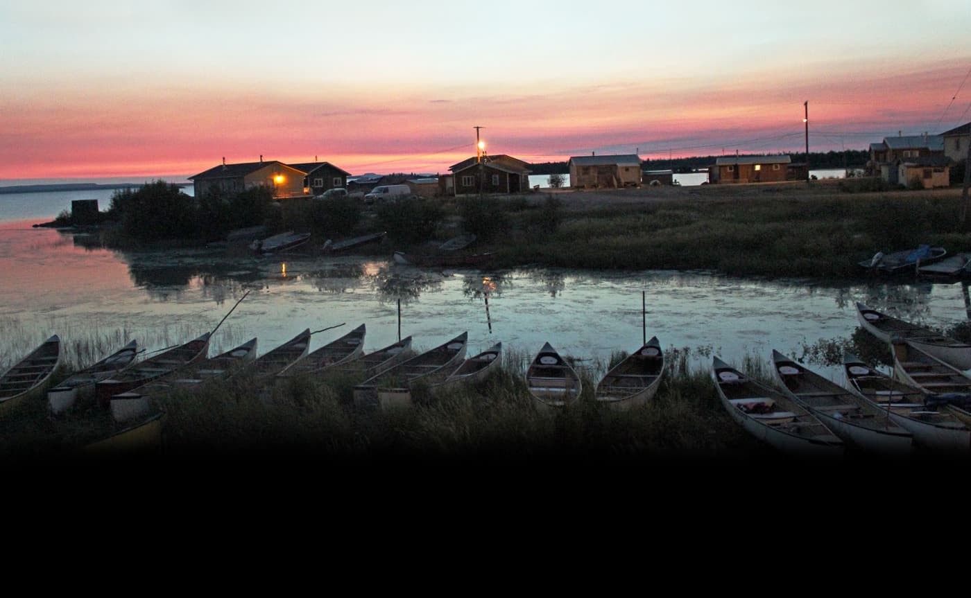
We offer a more accessible version of this page content in the light version.
A dog on the shore watches a boy paddle a canoe into the community of Behchokǫ̀.
Grainy 1960s footage of a summer’s day in the Tłı̨chǫ community of Behchokǫ̀. A man carries a canoe on his shoulders. A dog on the shore watches a boy paddle a canoe. A small group of people swim and jump from rocks into the lake.

Whatì Trail

Scroll Down

The Whatì trail is part of the larger Įdaà Trail, which links Great Slave and Great Bear Lake.

The trail provides access to over 250,000 square kilometres of hunting grounds.

The trail begins in Behchokǫ̀. It can take up to eight days to travel to Whatì by canoe.

Behchokǫ̀

Travelling through thousands of years of history

Behchokǫ̀ means "Big Knife" in our language. With a population of about 1,900, it is our largest community and the home of the Tłı̨chǫ Government.

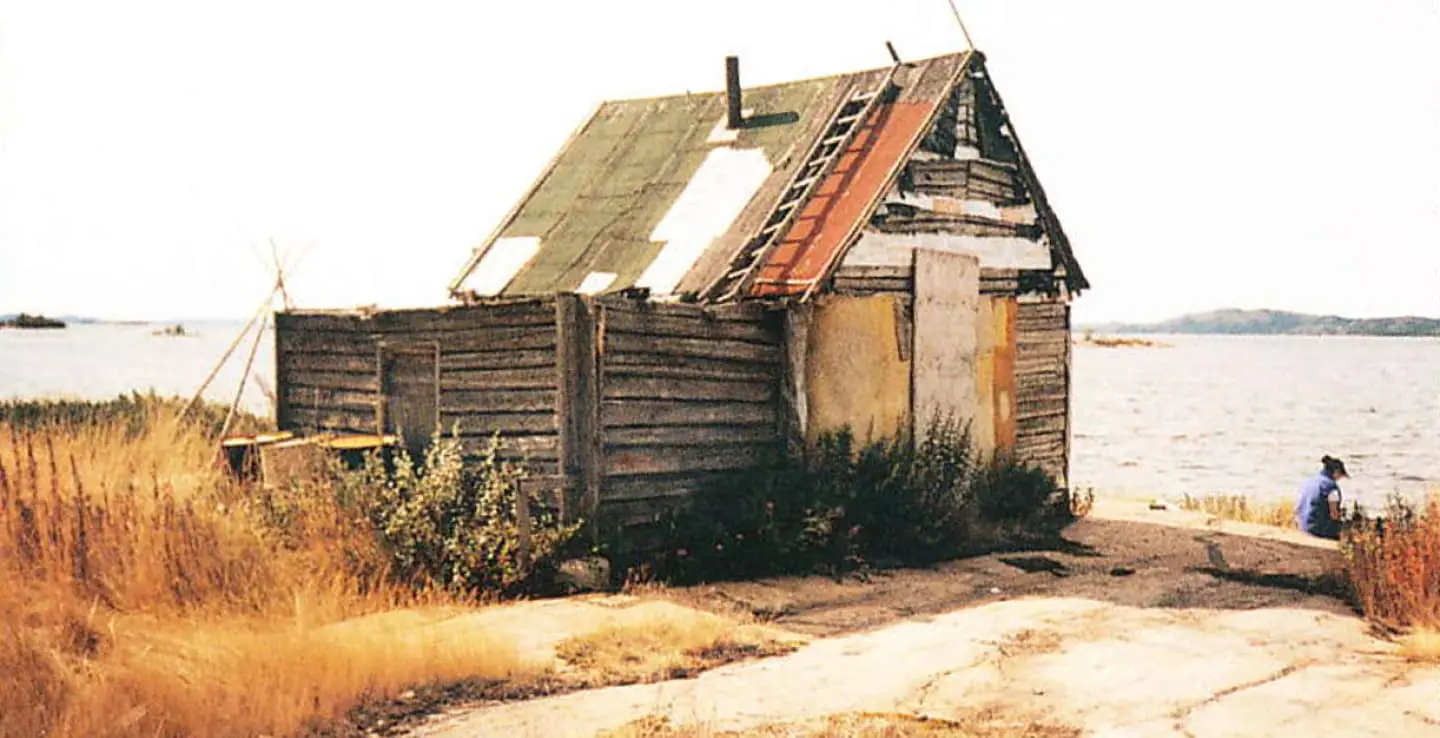
Behchokǫ̀ has a long history as a gathering place. Hunters and their families would make the long journey to visit and trade.

Here they exchanged beaver and marten pelts for supplies needed for the next season; tea, sugar, tools and ammunition. It was a time for celebration and an opportunity to reconnect before returning to their individual hunting routes.

Today Behchokǫ̀ is a vibrant community that regularly hosts events, meetings, hand game tournaments and other festivities that draw in travelers from across the territory.

A crowd of people cheer and take photographs as fully loaded canoes depart from the shores of Behchokǫ̀ at the start of the Trails of Our Ancestors annual canoe trip.
Trails of Our Ancestors canoes departing from Behchokǫ̀ in 2011 on their way to the 11th Tłįchǫ Annual Gathering.

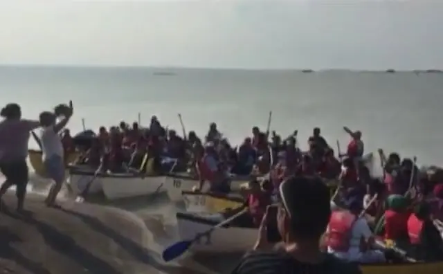
The Trails of Our Ancestors program was started in 1994 to pass on ancestral knowledge and traditional practices. The first group paddled 15 days from Behchokǫ̀ to Gamèti. It arrived to a huge celebration during the Tłı̨chǫ Annual Assembly.

The program allows Tłı̨chǫ youth to experience these trails through the eyes of our Elders. The boat trips are part of a vision by our people to become “Strong like two people.”

“Like an armada, the incoming flotilla of canoes from the ‘Trails of Our Ancestors’ is a vision of pride for the Tłı̨chǫ, almost like an apparition of the Ancestors themselves. With many anxious to take their turn, the canoe trips are like a rite of passage for every Tłı̨chǫ citizen, and revitalizes everyone concerned.”

John B. Zoe
Jonas Nitsiza talks about the power of our ancestors knowledge.

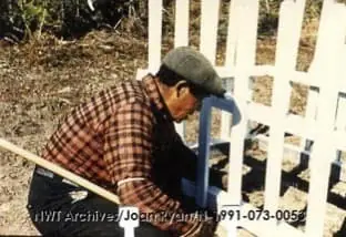
The land is known intimately to our Elders. Names and stories hold sacred knowledge. Our culture is tied directly to the land. The main focus on these trips is for our Elders’ to share their stories at these significant places.

The Trails of Our Ancestors program passes down Tłı̨chǫ culture to a new generation.

Behchokǫ̀ is the start of the Whatì Trail and all boats depart from Monfwhi eda (Monfwi’s point).

Select an icon to view more about a location.

Additional Content

The first stop is Xaelı K'ogola (Marian Village), a full day’s paddle from Behchokǫ̀.

The village is located at the mouth of the Xaelı (Marian River). Xaelı means Out-It-Flows in Tłı̨chǫ.

Xaelı K'ogola (Marian Village) sits at the mouth of the Marian River. In the distance is Shiagu, a mountain on Murphy's Point.

Joe Mantla, one of the Elder advisers for the Trails of Our Ancestors program, was born and raised here. He built the two-storey cabin that stands in the middle of the village.

Xaelı K'ogola (Marian Village)

A traditional gathering place

Xaelı K'ogola (Marian Village) was a thriving community at one time, where people would gather to celebrate with dances, handgames and handball.

Over time, residents moved to one of the more permanent communities in order to be closer to their children while they attended school.

People still come here to fish, hunt and gather plants. The area is great for catching muskrat and beaver.

An archival photo of a cabin in Xaelı K'ogola (Marian Village) on the shores of Marian Lake.

There are at least 30 gravesites at this location. One of the graves has a plaque labelled Thomas Tami Rabesca (born July 22nd, 1886, died December 9th, 1961).

Many of the graves do not have anything written on them. They were buried a long time ago when people did not know how to read or write.

Elders often say the ‘land is like a book’. What they mean is that stories and places are always connected.

Select an icon to view more about a location.

After spending the night, the canoes continue up the river to Dètaè?aa.

Dètaèɂaa is a traditional hunting and gathering area above Shotì Lake, between two rivers.

The Dètaèɂaa area has been visited by travelers for centuries.

Hunters and their families used to gather here on their way to trade furs in Behchokǫ̀.

The surrounding area is marked by many gravesites.

There are several old cabins nearby. This is a popular spot to camp for the night.

Select an icon to view more about a location.

Additional Content

There are many rapids and portages along the route.

Carrying the heavy canoes and supplies is difficult and takes a long time.

At Nàı̨lı̨ı̨hoteè, the canoes must come ashore for the longest portage of the route. It is six kilometres around the great waterfall of Nàı̨lı̨ı̨ (Whatì Falls).

The most difficult part of the journey is Nàı̨lı̨ı̨hoteè. The portage trail is a worn footpath through thick spruce forest cover.

Before the arrival of airplanes, Whatı̀ people would spend weeks at this portage hauling large loads was the only way to bring items into the community.

The canoes used for Trails of Our Ancestors are two hundred pound boats. They are carried upside down on the shoulders of two people.

Under good conditions it takes about three and half hours to cover the portage.

Large groups of travelers used to gather at either end of the portage to rest before the difficult task.

Select an icon to view more about a location.

Additional Content

Carrying the boats and their cargo over Nàı̨lı̨ı̨hoteè was a community effort.

Local youth would listen for boats, ready to help anyone that needed it.

The steep waterfall of Nàı̨lı̨ı̨ (Whatì Falls) drops 15 metres to the Lac La Martre River.

The falls are a sacred site where many Tłı̨chǫ enemies met their death.

Today visitors throw offerings into the falls. If they see a rainbow it is a sign of good luck.

Nàı̨lı̨ı̨ (Whatì Falls) is the last major obstacle on the way to Whatı̀.

Select an icon to view more about a location.

Additional Content

The remaining journey can be made in just one day.

Along the way, are the graves of the ancestors that traveled before us.

Tłı̨chǫ hunters and their families would follow the caribou herds.

When someone died they were buried on the spot and the hunters moved on.

Up until the 1960s, burials could happen anywhere. The landscape is dotted with gravesites marked with white fences.

Fences were seen as a way to contain the spirit of the recently deceased. It was believed that they may linger at the site for days to weeks.

At trail junctions graves are like a message post. A tobacco tin is left in a nearby tree, with messages and gifts for the next traveller.

A man in a brown plaid shirt and grey cap kneeling to repair the white picket fence around the grave.
Jimmy Moosenose repairing the fence around a grave, 1958. (Photo: Joan Ryan)

When visiting a gravesite it is tradition to clear overgrown plants, fix broken fences, offer a prayer and leave a small gift. Tobacco is left for Elders.

Today people are buried in their communities.

Not all gravesites are marked.

Select an icon to view more about a location.

Additional Content

Many have been forgotten or lost.

We have arrived at the end of our journey: Whatı̀.

Whatı̀ sits on the southeast shores of Lac La Martre.

The word Whatı̀ in Tłı̨chǫ Yatıì means ‘marten lakes’ because of the many marten in the area.

Whatı̀

The end of the trail

Whatı̀ has a population of about 500 people. Many in the community live a traditional Tłı̨chǫ lifestyle; hunting, fishing and practicing decorative arts.

The Tłı̨chǫ language is widely spoken. Up until recently, Whatı̀ was only accessible by boat or air in the summer months, and by ice road for a short time in the winter.

In 2021 the Tłı̨chǫ Highway opened, making the community accessible by road all year. The area is known for its beauty, and excellent trapping and fishing.

There is much to explore and experience in the community of Whatì.

Select an icon to view more about a location.

Additional Content

  • 360º Video: Whatì Drum Dance

    A 360-panoramic video of a Whatì Drum Dance during the Tłı̨chǫ Annual Gathering. The Drum Dance is a social activity to celebrate formal gatherings.

  • 360º Video: Whatì Handgames

    A 360-panoramic video from the middle of a Whatì handgame. Handgame rules and strategy are sacred and are not shared outside the Tłı̨chǫ.

  • 360º Video: Whatì Church

    A 360-panoramic video of the church in the Tłı̨chǫ community of Whati. The Roman Catholic church is located near the center of town and features a small graveyard.

  • 360º Video: Smoking Fish

    A 360-panoramic video from inside a Tłı̨chǫ fish smoke house. Whatì is known for great fishing and is a popular activity that brings tourism to the area.

  • Video: How I Got My Name

    Mike Nitsiza, a Tłı̨chǫ elder, discussing the origins of his family name. (Transcript available.)

We are at the end of the Whatı̀ Trail.

But our land is vast and full of stories.